Nova Scotia (etc) 2014
A long time ago, nearly 25 years be quite precise, Paula and I got married and went to Prince Edward Island
for our honeymoon. We always wanted to get back to the general area, and I readily supported the idea of
going to Nova Scotia for a summer vacation. I remembered the PEI trip entailed a lot of driving, and it
turns out Nova Scotia takes more - not a surprise.
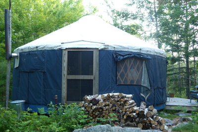 |
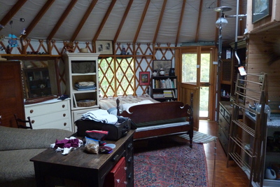
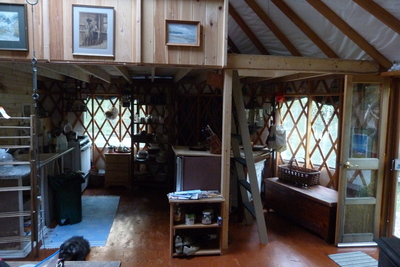
Ellsworth ME yurt
For the first night, we stayed in a yurt that is the same size and manufacture of our
Cardigan Hideaway. The yurt kit leaves a completely unfinished
interior space, and it's interesting to see how people handle carving up the circular floor space and
handle the outdoors environment. They have a well that's powered by a small generator. They also have
a couple gaslights (propane) that I didn't notice until Paula was in bed. I should have lit one to see
how it does.
|
The next day we drove up the coast on Route 1, slower but more interesting
than I-95. This took us through the "wild" blueberry farms of the central
coast from roadside stands to Wyman's of
Maine in Cherryfield (blueberries weren't as important a long time ago).
I hoped to buy enough on the way home to make some blueberry jam.
Eventually we make to Calais, cross the St. Croix river, wait a while at
the border crossing, and we're in Saint Stephen, New Brunswick. While we were
in line, we each got three TXT messages on our phones welcoming us to Canada,
telling us how to call US numbers, and warning us of the expensive phone and
data services available to us. They recommend using Wifi. The first stop is
the Tourist Information Center where an excessively helpful woman gives me
more stuff than we really need, but I think we wound up using most of it.
From there we head out on Rt 1 past St. John and then down a road through
Fundy National Park and into the small town of Alma. The park is inland, so
it has little to do with the huge tides on the Bay of Fundy. Alma is right on
the bay, and has a small fishing community, and is right in the heart of big
tides. We stayed at a small motel next to the dock.
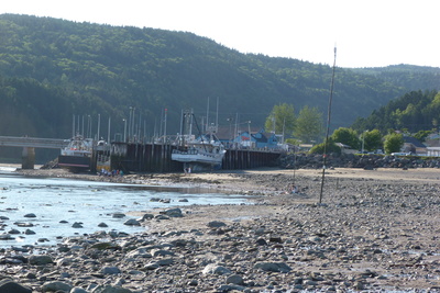 |
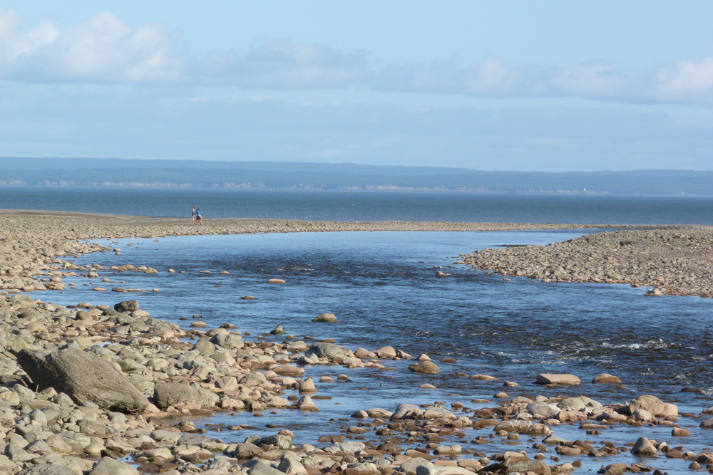
You've probably seen this pier in some news or textbook about the Bay of
Fundy. Most photos are taken from the other side in part because there are
more boats tied up there, and in part because people don't like walking out on the
muddy, sandy, and rocky sea floor. It really does feel as though you're
walking on the sea floor. It's flat, and if there were a beach, walking some
place where your head is 20-30 feet below high tide just doesn't feel like a
stroll on a beach at low tide.
|
 |
The river that flows by the pier keeps going on to the bay off in the distance.
|
 |
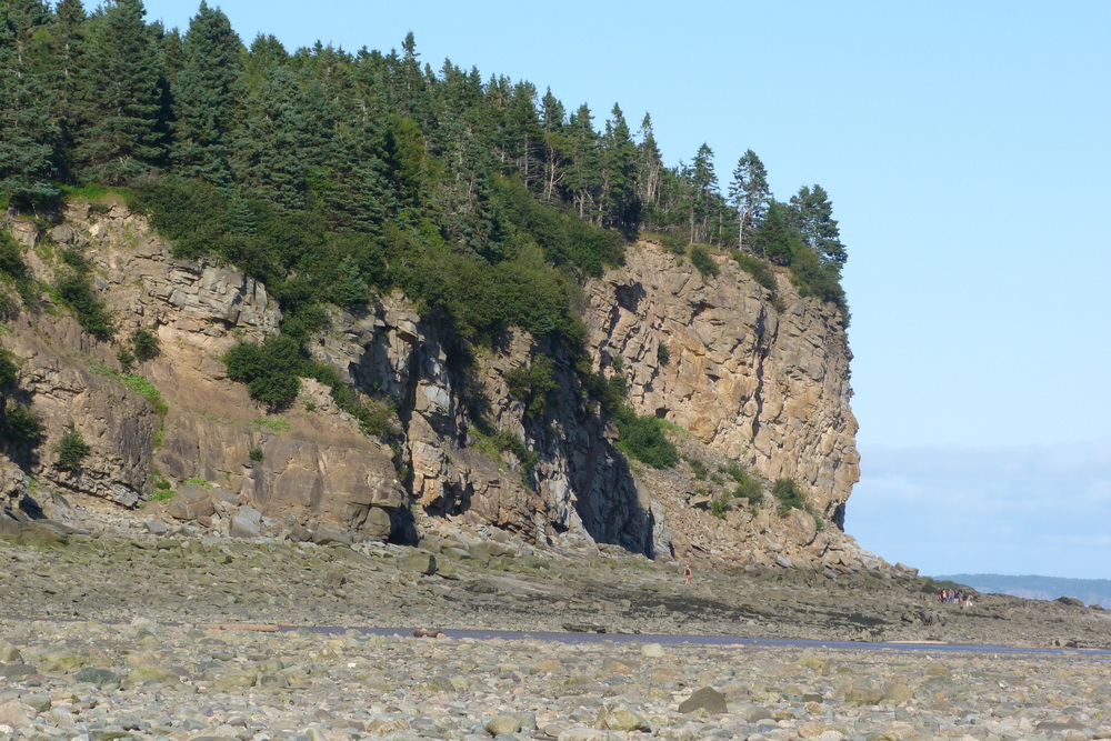
While I was out on the sea floor, this headwall was worth photographing.
The scale is a bit tricky until you realize that the ocean stain at the base
reflects the large tide and is several times bigger than the people walking
near the base. You may have to click on the image to see a larger image that
might have the people visible. There are seven.
|
 |
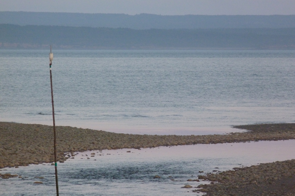
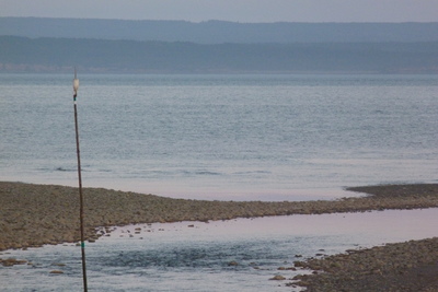
This shows both the edge of the bay close to low tide and one of a few
channel markers. The colored stripes on the bottom third of the pole must be
warning markers - if the green marker is visible just above the water's
surface, navigation should be safe. Red and white mean you're about to run
aground.
This photo was taken at 7:59 ADT, a while after low tide and well before
the peak flood.
|
 |
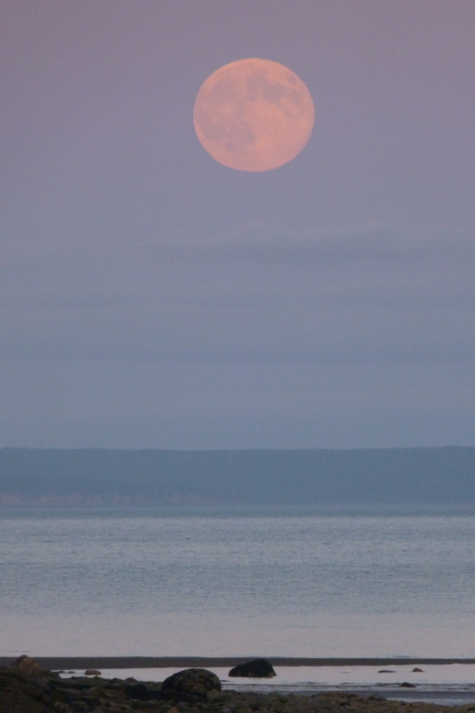
We were there on the full moon, and just before lunar perigee, so we saw
the largest moon of the year. The tide tables showed the peak tide a few days
later, but essentially as big for the few days around the full moon. I missed
seeing the full moon rise, I should have checked the moon rise time. Ah well,
this way I get items to see away from the center of the photo.
|
 |
I didn't stay out to check on the tide after sunset. I probably should
have - Paula went out every 20-30 minutes and would come back amazed at how
much the water had risen. I figured it had about six hours to rise 30-40
feet, and it would be climbing pretty quickly at mid tide.
Going out on the seabed by the river would likely have been a safe way to
watch the tide come in and not risk getting caught on a sandbar and still
expecting 20 feet of water. The river flows downhill, no chance to be tricked
by a little rise.
At any rate, this photo was taken at 8:30 ADT, you can see the change in
the tide from the previous photo.
|
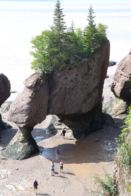 |
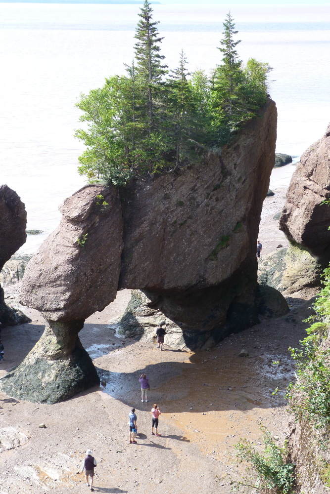
The next day we continued along the bay, somewhat inland, and stopped at
Hopewell Rock Provincal Park. This has the other iconic image of the Bay -
tall rocks whose bases are scoured by the waves and wide ranging tides and
have a narrow base and broad top. Here the tide is coming in, so the sea
floor is mostly covered, but there's a lot to go before the rock bases are
covered.
After this we continued on to Moncton, one of the biggest towns in area.
On our honeymoon we stopped here to see the
tidal
bore. Today while I was driving into the downtown area, Paula exclaimed
"Oh, there's the tidal bore!"
Which was immediately followed by "Don't sight-see while you're driving!"
|
Past Moncton, it was onto the trans-Canada Highway and into Amherst, Nova Scotia.
The first thing that greated us was a tourist information building, and beyond
were several wind turbines. (Nova Scotia Power says there are 15 2.1 MW turbines in the project.) I won't say much more about wind turbines, honest. Except that you really don't want to live near one.
Paula had the idea that we'd get to the whole province. While smaller than
Maine, Nova Scotia is stretched out some and it became clear that covering the
province would keep us moving, not visiting.
Paula wanted to look at the area southwest of Halifax, and she found an
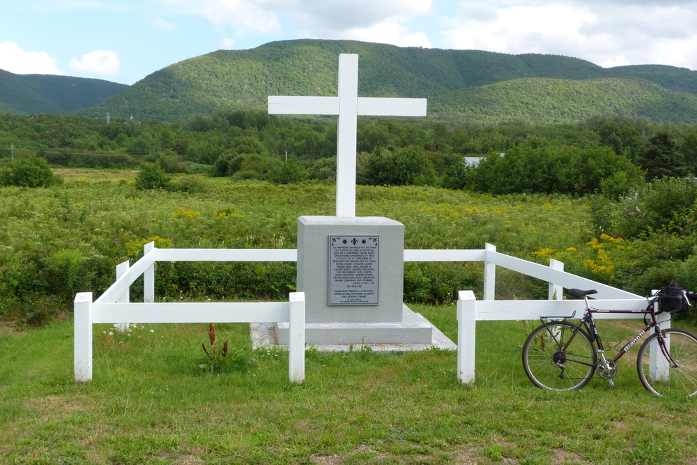
area that looked interesting called Peggys Cove. Soon before we got there we
stumbled across a memorial site for the crash of
Swissair flight 111 in
1998. Peggys Cove was used as one of the bases for the recovery effort.
The memorial site is only 12 km from the crash site.
Unfortunately, Peggys Cove is a small area, you can see some of it from the
memorial's web site, and all the accomodations there and nearby were full, at
least for places that take dogs, and we wound up in Halifax for the night.
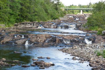 |
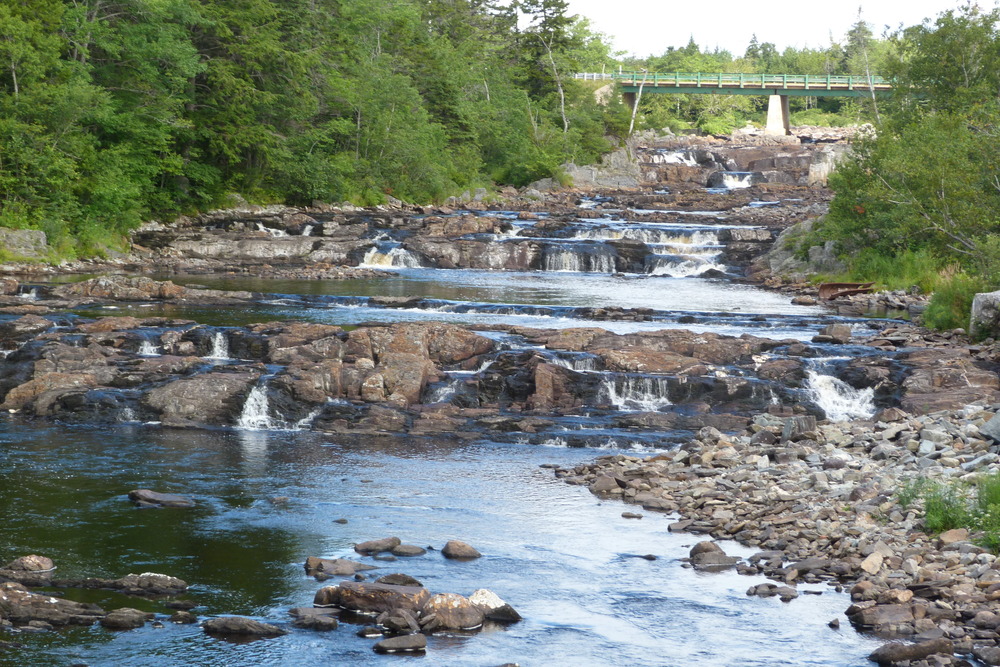
The next day we continued along the south coast, intent on finding a place to
stay and making it a short drive. We stopped at a visitor center in Sheet Harbour
and found it had some walking trails to an area that used to have a pulp mill,
but was destroyed in 1971 by Hurricane Beth.
This summer hadn't brought much rain, and the water level in the river was
very low.
|
 |
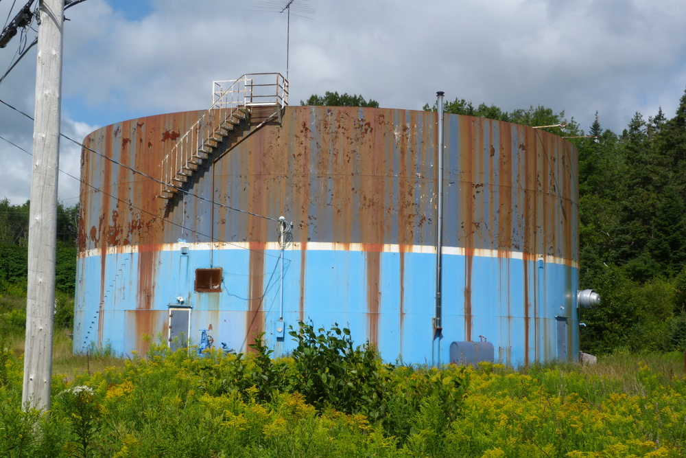
We came across this strange oil tank. It has a door. It has a TV antenna at the top of the stairs, which no longer reached the ground. It has a restaurant-size kitchen exhaust fan. It even has its own oil tank!
I concluded someone turned it into a house, but I stumbled across a photo linked from Google Maps that shows it's Flipper's Bar and Grill
|
 |
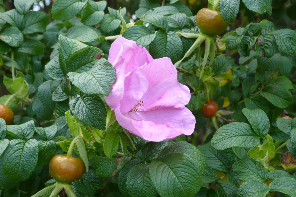
More attractive is this Rugosa Rose, which turns out to be an invasive plant from Asia. I don't think I ever knew that!
|
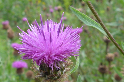 |
This is Canada Thistle. The blossoms are smaller and less prickly than the
thistle I'm familiar with.
|
From there we stopped in Port Dufferin, a place with a motel, church, and
graveyard. We had called ahead to reserve a room. We wound up being the only
ones at the motel,
The
Marquis of Port Dufferin that night. It was one of the most pleasant
places we stayed at in the whole trip.
We stayed there for the afternoon, and went back to Sheet Harbour for lunch, laundry and a bicycle ride. I had Paula drive quite a ways inland and I rode back, taking
all the spur roads that paralleled the main road. It turned out there are a number of houses on those roads along lake and riverfront property. One of the roads was named Loon Loop. Later, at Port Dufferin, I saw some waterbird riding low in the water and figured they had to be cormorants. However, we heard loon calls that night, so apparently they do spend some summer time on salt water.
The next day we started out with a breakfast snack provided by the motel
because there's nothing else in the area and headed east then north to
Sherbrooke, the first town big enough to have a restaurant. It also has
Sherbrooke
Village which "depicts a typical Nova Scotian village from 1860 to
pre-WW1." Looks like it's worth a visit, but not this trip.
Onward north to the north side of Nova Scotia to Antigonish (home to St
Francis Xavier University), then on the Trans-Canada Highway to Port
Hawkesbury on the island of Cape Breton.
Paula spent some time talking to folks at the vistor center looking for a
dog-friendly motel and finds one in Cheticamp that sounds a lot like The
Marquis of Port Dufferin, and we head off that way, sort of. The roads are a
bit confusing at first and after I saw a sign that I thought said we were on
Rt 19, it took several miles before I realized we were on Rt 105 and inland.
Not a big deal, it's easy enough to get north to Rt 19.
Nova Scotia is not officially a bi-lingual province like New Brunswick, but
Cape Breton is home to Acadians and their french heritage persists. Scots and
their Gaelic heritage and the original Mi'kmaq also have a substantial
presense and a long history.
The first glimpse of Cheticamp was seeing
La Eglise Saint Pierre in
the distance. The church is by far the most imposing structure in town and
that first view was of just the top half - no other buildings were visible.
We didn't stop in, but check out this view of the
interior.
The motel turns out to be a disappointment after The Marquis, small rooms, aluminum siding that destroyed their WiFi access inside, but okay. The Tim Horton's across the street is Paula's kind of neighbor except she was up the day before they opened!

 |
After getting settled in the motel, I had noticed a road that parallels Rt 19 for a ways
and had noted it was featured in a flyer about bicycling in the area. I rode the loop, about
12 miles. The major items of note were that not only were we close to Cape Breton National Park, but that the terrain completely changes as soon as you enter the park.
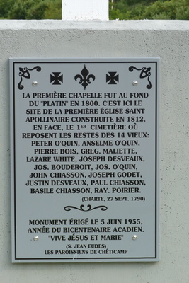
The other thing was coming across a monument to the first chapel in Cape Breton. Across the street was a sign by a narrow driveway with a sign (in French) that saying it went to the first of 14 old cemeteries in the area.
|
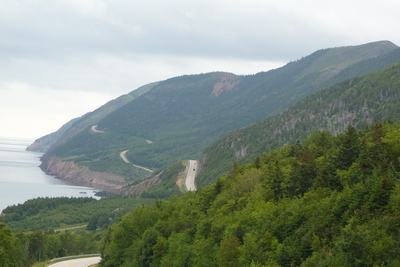 |
While much of the Cape Breton coast to this point had a livable amount of
coastal space for settlement, towns, etc., it appears Cheticamp is located at
the first such area coming down from the northeastern part of the island. The
park begins just north of town, and is all headlands along the coast making
things challenging for both road builder and drivers. And bicylists! The day
started with light rain, remnants of a major rain that affect a large swath of
the northern US a couple days before.
|
 |
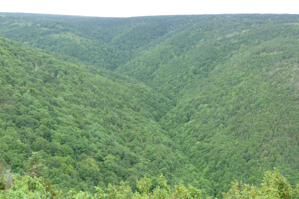
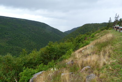
The terrain is actually a plateau some 1200 to 1500 feet above sea level,
with steep valleys cutting their paths through the plateau and down to the
Gulf of St. Lawrence. This photo looks upstream and does a good job showing the plateau.
Up on the highland, things are much flatter and it would have been pretty nice
bicycling in dry weather.
|
-----
 |
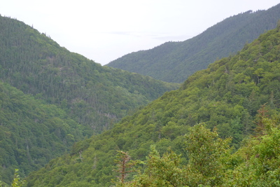
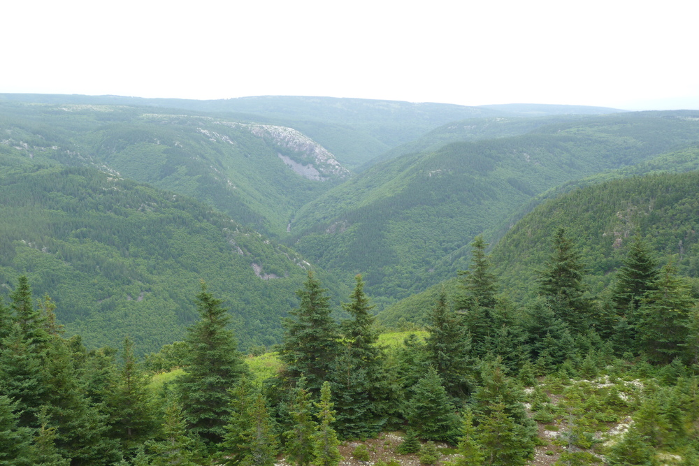
Looking downstream, you can see the challenge to getting from plateau to sea level.
The water is down there, lost in the clouds and mists.
This turnout is on a narrow saddle formed by valleys on either side. If I
get time I can splice several photos together to make a panoramic image of the
saddle.
|
-----
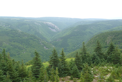 |
A bit further along the road this viewpoint showed an area with exposed
rock outcroppings. Up to this point all the land was pretty well covered with
vegetation.
|
Soon after this, we descended through seven switchbacks with steep
penalties for missing one, back to the water at Pleasant Bay, which has a
little bay and harbor, a few places to stay, and a whale watch tour. The road
mostly settles down to run east, skipping in and out of the national park as
it back up, but more gently, along a stream and then right back down through
the Aspy River valley. It had caught my eye a few days before as the only
straight river in the area. A quick check verified this is a fault zone, and
while we couldn't appreciate it from the road, it really stands out on
topographic maps and from some viewpoints from hiking trails.
The damaged rock in fault zones erodes more easily than intact rock, so
they often become river valleys, and the Aspy fault is one of the more
impressive I've seen.
 |
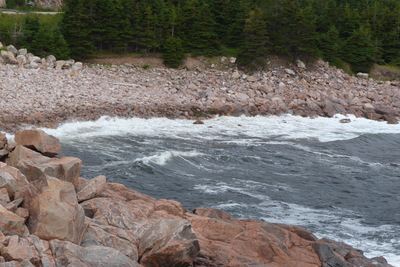
The east side of Cape Breton is surprisingly different than the west.
the northern part does not have highlands, or at least they aren't nearly
as high. There's more non-park area, and this is where a lot of the craft
stores are located. For the most part, they're not great. Diverse, ranging
from kilts to larchwood to stained glass.
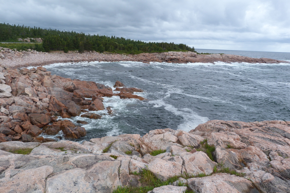
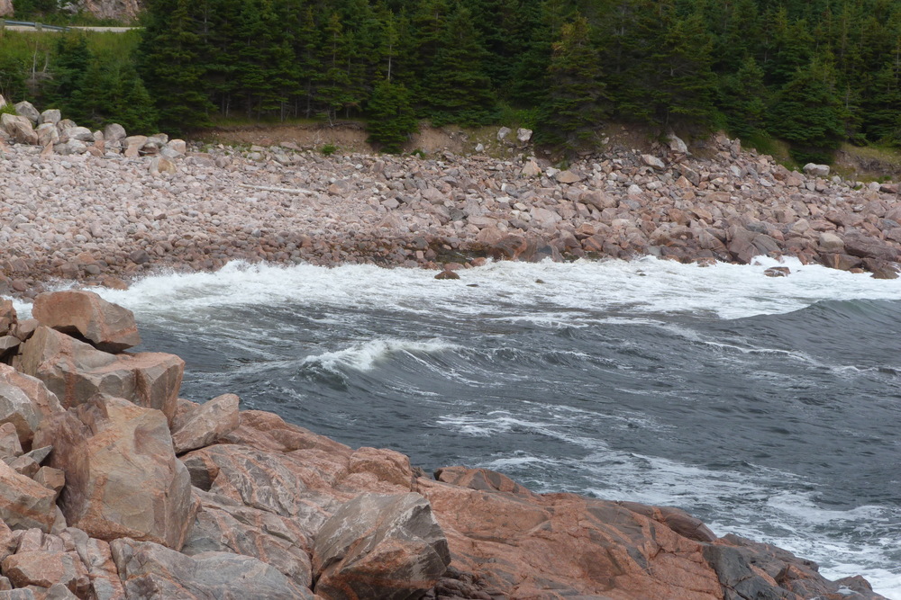
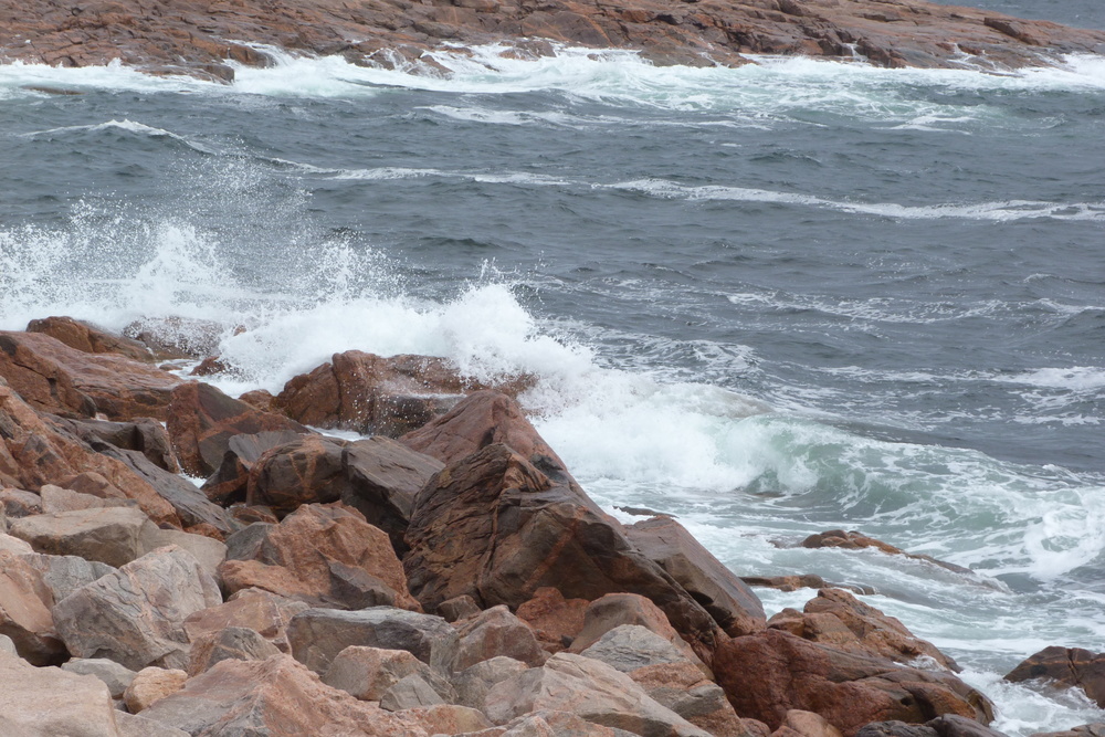
The coast faces slightly east of due south, with not much in the way to block
the Atlantic ocean or offshore storms. These photos are at Green Cove, just a little
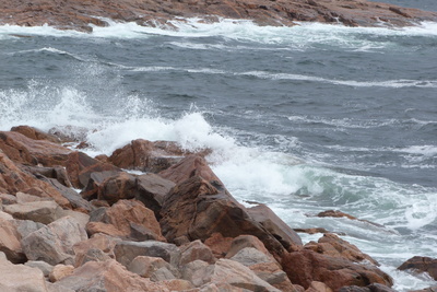
stop for a rocky cove that exposed to wind and waves.
A good place to try to get some photos of sea spray.
|

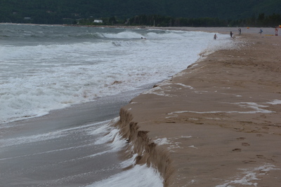 |
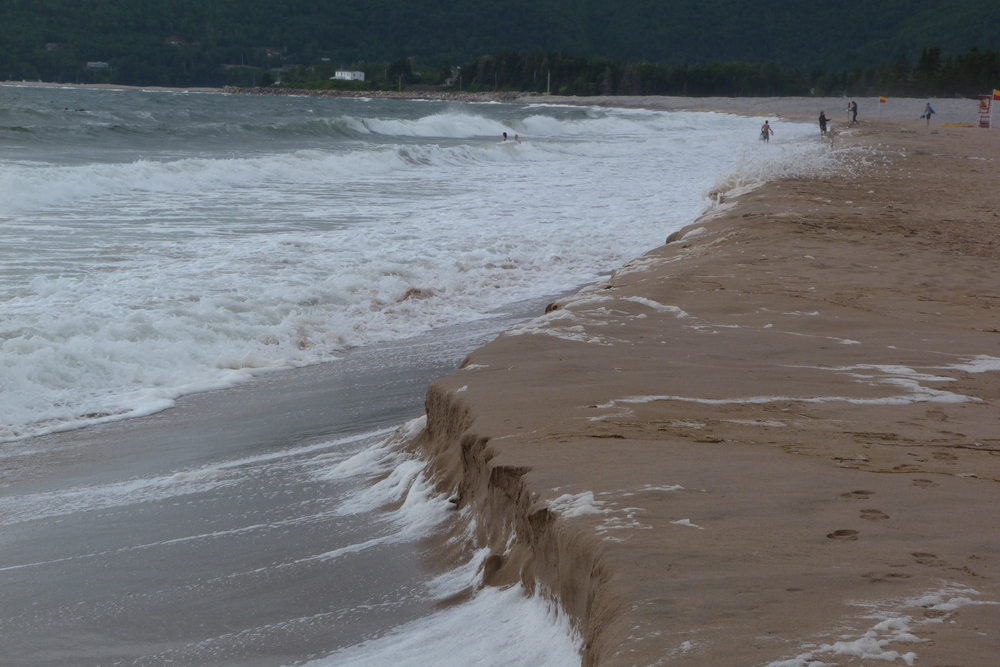
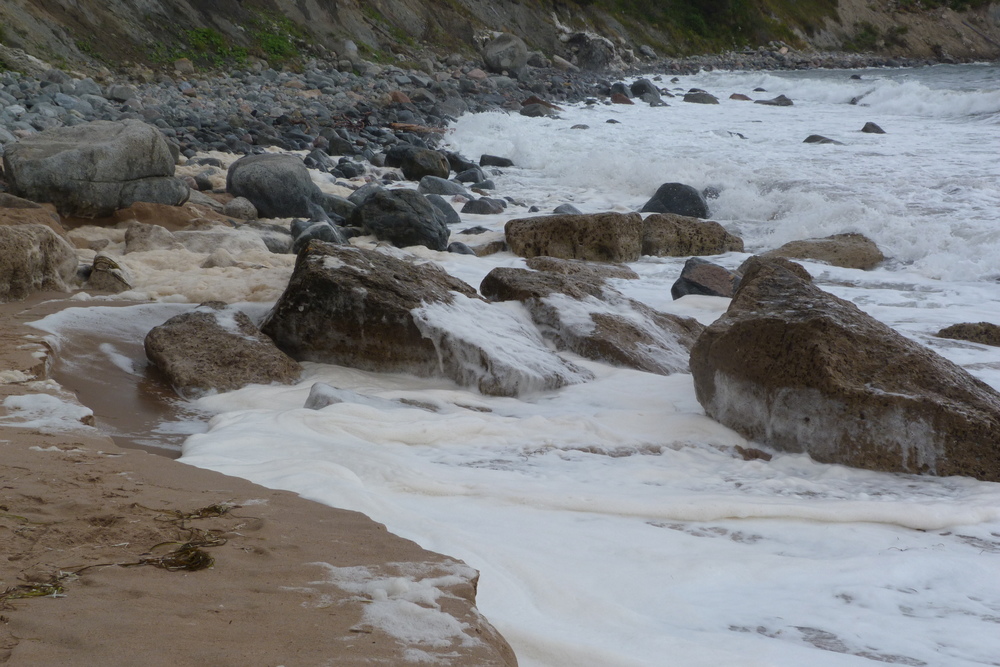
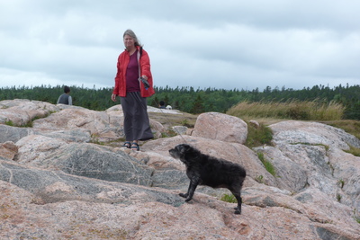
Paula still wanted to find a sandy beach to give Ella a chance for a walk, and a
little further down the road is Ingonish Beach, which we got to just after high tide.
This sort of berm eroision is typical after a moderate storm, but I didn't think there
had been one. Perhaps the recent perigean tides were enough.
|
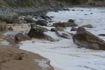 |
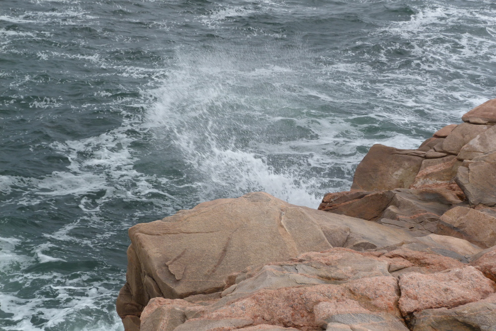
Sea foam turns out to be difficult to photograph! Perhaps a video would have caught it better.
|
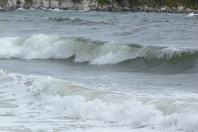 |
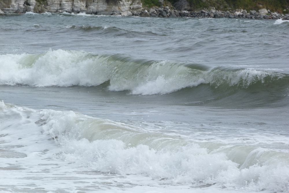
I couldn't quite get a breaker at just the right moment, they were breaking in different places and it was a bit difficult to track a promising wave or jump to the following wave.
|
 |
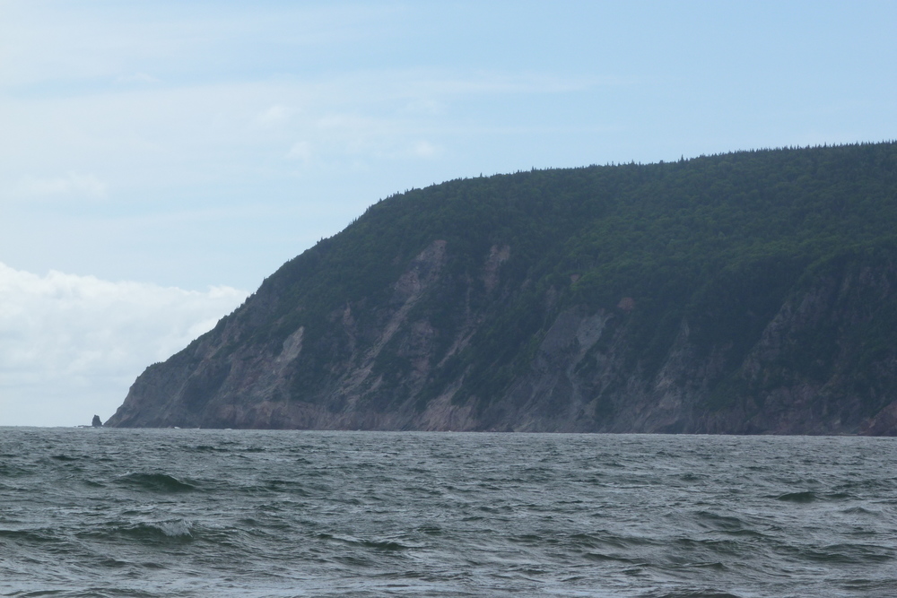
As we went south, the terrain began to perk up again, we wound up driving well left of
this, Cape Smokey.
|
We stopped for lunch in the town of Baddeck, intending to go to the museum at
the Alexander Graham Bell National Historic site afterwards. After Bell's
success with the telephone, he bought property on Cape Breton because it
remind him of his Scottish homeland. While here, he worked on improving
others' inventions, such as Edison's phonograph and the Wright brother's
airplane.
Paula realized that to get to a reasonable stopping point for the day we didn't
really have time for the Bell museum, especially with taking turns to babysit with
Ella. So we skipped it and headed back to the main island and found a place to
stay in Moncton.
The next day, Friday, I thought we could make it to the yurt in Ellsworth, maybe getting
enough blueberries along the way to make jam and checking out the Schoodic Pennisula (a
part of Acadia National Park that doesn't have crowds). However the owners were coming up
that night, so we decided to head more inland and get home a day early.
I chose staying in Waterville Maine, home of Colby College, where my brother garnered
his bachelor degree. No blueberries that way, but a lot of pine trees. We had dinner
in Mainely Brews Restaurant and Brewpub, located in the old Post Office. In the morning
we drove by Colby on our way out of town. I know I was there for Doug's graduation, I
don't think I had been there any other time.
We made it home sometime in the afternoon. Ella didn't seem quite as excited about
being home as I thought she might. She may have realized when we were back in the area
from sites and sounds, but she had been a very good traveller. She has always liked
car trips and had settled well into a regime of each stop being a new and odd place.
Somewhere in her dog brain I suspect there was sense of it being nice to be back home.
Contact Ric Werme or
return to his home page.
Written 2014 Aug 18, last updated 2014 Sep 1.